Compliance Inspections
Most municipalities require adherence to the stormwater Operation and Maintenance Manual, as well as Annual Certified Inspections of regulated stormwater BMPs to make sure they are functioning correctly. The majority of Operation and Maintenance Manuals require monthly visual inspections, in addition to the Annual Inspection that must be filed with the municipality. Requirements to pass the annual inspection vary among municipalities. These inspections must be sealed by a certified engineer before submittal to the municipality. We have performed hundreds of these Annual Certified Stormwater BMP Inspections statewide.
Maintenance
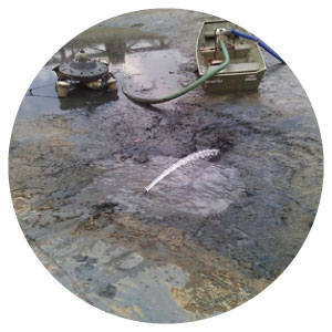
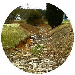
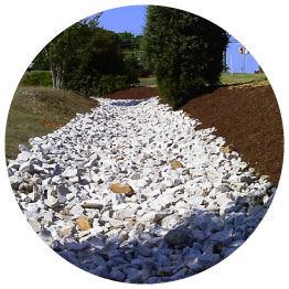
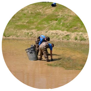
Stormwater devices require regular maintenance to fully function as intended and to prevent more costly repairs and retrofitting in the future. We regularly inspect these devices and maintains them to municipal regulations, as well as ascertaining their structural integrity. We make recommendations for corrective actions to improve function, seek approval from the owner, and then repair/renovate the stormwater device in accordance to the structural specifications and municipality requirements. Routine maintenance of stormwater devices usually requires management of vegetation (terrestrial and aquatic), evaluation of erosion control measures, accumulated sediment removal, clearing of drainage mechanisms, and removal of debris and trash. We can provide customized Annual Maintenance Agreements based on the specific types of devices on a particular property that cover everything required by the O&M.
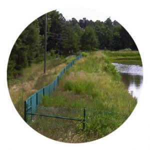
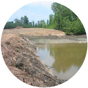
before maintenance

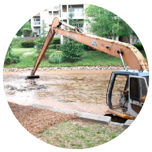
Construction & Repair
We are a licensed North Carolina and South Carolina general contractor. As such, we are capable of providing all the stormwater device repair, renovation and/or construction services our clients may require. We specialize in repairing water level control structures (overflow systems), repairing dam and embankment failures, installation of erosion control practices, shoreline stabilization and littoral shelf restoration, sediment excavation and removal (dredging), repair and installation of stormwater drainage conduits.
Bathymetric Mapping
We can recommend the best solution to fit every need and implement that solution cost effectively. Our Lake Mapping Service utilizes very accurate GPS coupled with sonar. It is an excellent tool used to assist in the determination of quantities of sediment to be removed to achieve the desired depth results. We provide a helpful and unique service for owners who want a mathematical and visual image of the depth and contour of their pond/lake. By using an acoustic sounding device linked with global positioning systems (GPS), we can create a bathymetric map that displays the depths of a lake or pond.
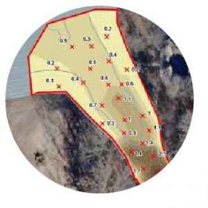
Another useful application for bathymetric maps relates to dredging. If a map is created in the early stages of a lake’s life, after many years another map can be created to compare the depths and any accumulated sediment. A map could also be used as a quality control check before and after a dredge project has taken place. Bathymetric maps can provide the volume of a given water body. This information can prove invaluable when implementing a whole-lake treatment with an aquatic herbicide. Since the volume of a lake is needed to calculate the amount of plant control material needed, a more accurate lake volume will prevent the use of excess or inadequate material.
Stormwater Devices
A Notice of Violation (NOV) is something no property owner wants to see or hear! Usually that means repairs must be made in a very short period of time. That is expensive and stressful. Fines for not completing the work on time can be enormous. We don’t want anyone in that situation, but we can help if you are.
- Mowing, brush and tree removal
- Reseeding grass and repairing bare spots
- Planting and controlling invasive plants along littoral shelves, forebays and shorelines
- Dredging and sediment removal
- Drain system repair, renovation and replacement
- Erosion control
- Repairing and replacing underlayment fabric and stone in inlet and outlet conveyances
-
- We prefer to provide routine inspections and maintenance that avoids NOVs. We understand what regulators in North Carolina want to see and they respect our ability to provide reasonable compliance.
Recreational Lakes and Ponds
Whether large or small, we can handle anything you need done to your recreational lake or pond. We understand dam safety laws and requirements in North Carolina. For over 35 years we have been building, maintaining and repairing fishing lakes and ponds, waterfowl impoundments and ponds used for irrigation, fire protection, swimming and simple aesthetics.
- Design and permitting
- Construction
- Draining and fish removal
- Renovation
- Fishery enhancement
- Swimming beaches
- Docks and piers
- Nuisance animal management
Preventative (annual) maintenance agreements
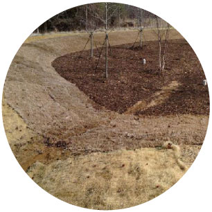
A pond is just like a lawn. It needs routine maintenance or it will require expensive renovation. Entering into a full service maintenance Agreement with us is easy and cost effective. With it we simply do everything necessary throughout the year to achieve your objectives, including a detailed report after each maintenance visit. (For Stormwater device service, see our Stormwater BMP section). The service provides the most comprehensive service, with the least amount of hassle for the owner of any lake, pond or stormwater device. The fee is dependent upon your objectives. We are in the unique position of being able to “do it all”: stock and increase growth of supplemental fish, install and maintain fountains, control nuisance plants or animals and manage water quality for productivity and attractiveness. We have a full construction and repair team, knowledgeable in all structural components of lakes, ponds and stormwater devices. During our visits we monitor developing conditions so corrective action can be taken early to prevent expensive problems from developing later. Full service clients can securely log into FosterLake.com’s client login and view their service reports, which detail the work performed during the service visit, as well as view any recommendations for structural repair, fisheries management, erosion control – plus many others!
Corrective (as-needed) Maintenance Agreements
Don’t need an annual maintenance agreement? We provide all of our services on an as-needed basis. Enhancements of all kinds including: docks, piers, feeders, underwater lighting, artificial fish habitats, etc. Typically, we receive service requests for:
- Water Quality Analysis & Enhancement
- Aquatic Vegetation Management
- Fisheries Management
- Fountain / Aeration Sales, Installation & Repairs
- Construction and Repairs
- Dredging
- Certified Annual Stormwater BMP Inspections
- Shoreline Stabilization & Erosion Control
- Beneficial Shoreline Plantings
- Lake Mapping (bathymetric mapping)
- Consultations
aquatic assessments
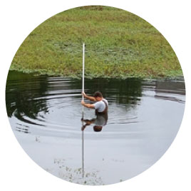
A pond is just like a lawn. It needs routine maintenance or it will require expensive renovation. In order to properly manage algae and aquatic vegetation, the first step is to conduct an assessment of the pond or lake. Our personnel are highly qualified in collecting the appropriate information to make the correct management recommendations. Informational parameters may include:
- Lake / Pond Size
- Algae Type(s) Present
- Water Level
- Vegetation Type(s) Present
- Temperature
- Visibility
- pH
- Water Color
- Objectives
- Regulated Stormwater BMP Determination
- Fish / Aquatic Organisms Present
algae control
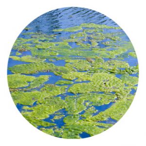
“Isn’t there anything I can put in my pond to take care of those nasty weeds?” Algae problems often start very early in the season. If we can get it controlled before it starts growing actively, produces gas bubbles and floats to the surface costs can be reduced. Algae can grow very fast and get very ugly. Fortunately, we have liquid and granular algaecides, beneficial bacteria/enzyme products, mechanical aeration/circulation devices, nutrient reduction techniques and mechanical removal tools available to us. Effective algae reduction often takes multiple tools and an integrated approach.
vegetation control
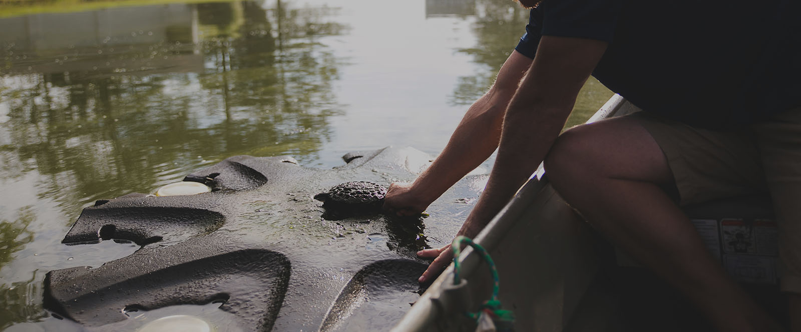
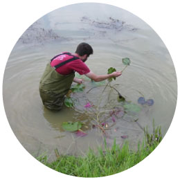
Nuisance aquatic vegetation is one of the most troublesome pond problems. Control methods include: biological (fish that eat plants); chemical treatment (aquatic algaecides and herbicides), cultural (beneficial plantings) and mechanical (pulling, cutting and raking). Biological control is usually the recommended long-term solution. Sterile grass carp can be extremely effective but require time. Treatments may be quick, but require care. The type of vegetation must be identified correctly. Treatments must be mixed and applied properly. Often special equipment is necessary for effective chemical application. Improper use of treatment products may kill many fish. We are licensed applicators of aquatic herbicides and pesticides. New aquatic herbicides are available which are effective, relatively long-lasting and safe. We often spray nuisance aquatic vegetation for immediate control, apply a colorant to limit light penetration or a probiotic enzyme/bacteria product to inhibit new growth, and then stock sterile grass carp for long-term control.

treatment tools
“I’m worried about putting aquatic algaecides and herbicides into my water because I don’t want to kill the fish.” Most Integrated Pest Management (IPM) programs are designed to provide the longest lasting least expensive solution to the pest (in this case nuisance vegetation) problem. Many solution prescriptions start with chemical pesticides. Contact treatments kill what they contact even if it is only part of the plant. Systemic treatments are absorbed by the plant and can kill the entire plant. Excellent aquatic algaecides and herbicides are available today. Some are very selective, can be applied in very small concentrations and are very safe to the environment. We have the experience and commitment to sustainable lake and pond management to recommend the best vegetation management solution for your problem.
biological tools
We have always placed a great emphasis on biological tools to aid in an invasive IPM program. Sterile (triploid) grass carp are the best long-term control measure for most types of nuisance aquatic weeds. We recommend 20 sterile grass carp (10-12”) per “vegetated” acre. We sell and stock sterile grass carp all year long (except July and August when temperatures are just too warm!).
cultural tools
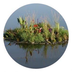
Reduction in the amount of nutrients in your water body is highly advisable. Several good biological tools have been introduced on the market recently. Floating islands are a great way to beautify your pond and reduce nutrients at the same time. These large “islands” are stocked with pots of nutrient-gobbling plants that help to minimize nutrients available for nuisance plant growth.
mechanical tools
Although the principal is good, mechanical removal of vegetation requires a tremendous amount of effort. Aquatic vegetation is very heavy and usually must drain or dry before being hauled off or otherwise disposed. Then, the effort may have only encouraged it to spread or become more abundant. Nevertheless, you will have removed significant volumes of plant material completely from the lake or pond. That may make it worth the effort.
pond fish stocking
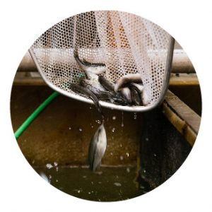
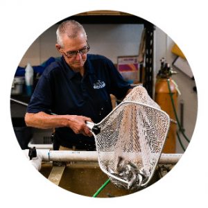
At Foster Lake & Pond Management, we sell only fish at least 2 inches or longer. These fingerling fish have already learned to feed on their own. We intend for you to have 100% survival. You can assume a balanced fish population will be established. Higher quality fish insures you will have many years of productive fishing. Stocking decisions should be based on your objectives and the level of management you expect to use. Many options exist. Sterile grass carp can be extremely effective aquatic weed and algae control tools. Many people enjoy a few hybrid striped bass stocked into private ponds for trophy fishing or to control overcrowded small fish. Fathead minnows are excellent forage for predatory fish.

stocking recommendations
(fish per acre) Ponds larger than 1/2 acre
| Species | High Rate | Moderate Rate | Low Rate |
|---|---|---|---|
| Largemouth Bass | 100 | 75 | 50 |
Bream Options:
|
|
|
|
| Channel Catfish | 500 | 200 | 50 |
| Fathead Minnows | 12lbs | 7lbs | 5lbs |
fish stocking choices
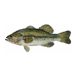
largemouth bass
Largemouth Bass are the top predatory gamefish in a lake or pond. Largemouth bass typically are fast growing (up to 1.5 pounds per year) and excellent to catch on a rod and reel (hence their gamefish classification. These fish are critical to many lakes and ponds in order to maintain a proper balance or ratio of predator and prey.
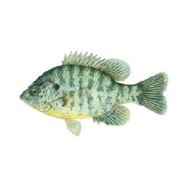
bluegills
Bluegills can grow up to approximately 12 inches long and about 4 1/2 pounds. They typically are an excellent food source for largemouth bass; are fun to catch and make good table fare. Bluegill should generally be stocked if “catch and release” largemouth bass fishing is the priority.
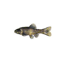
fathead minnows
Fathead minnows should be stocked with hybrid bluegill to provide bass with sufficient forage.
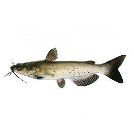
channel catfish
Channel Catfish are a bonus in a pond. They increase the productivity of a pond and do not compete with the other fish. You can put as few as you like or as many as you want as long as they will have adequate food. They can be stocked anytime. Channel catfish do not usually reproduce in ponds unless spawning containers are provided. Ponds less than 1/2 acre in surface area are difficult to keep balanced with bass and bream. Small ponds are much easier to maintain and usually more enjoyable if stocked with only channel catfish. They will grow fast and provide plenty of fun and food with a minimum of work. You can stock about 500 fish per acre if you don’t feed them and 1,500 – 2,000 per acre if you do feed them. You may also stock just hybrid bluegill and a few bass if you don’t want channel catfish. About 10 largemouth bass per acre will control the limited reproduction by hybrid bluegill and enable the fish to get big faster.
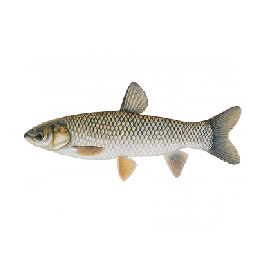
sterile grass carp
Sterile grass carp are incredibly effective for controlling most aquatic vegetation. They consume up to 3 times their body weight in vegetation per day and may grow up to 5 pounds per year. In North Carolina only sterile grass carp are allowed. We have found that if you stock 20 grass carp per vegetated acre of pond, you can expect control by the end of the second year. Our customers have been amazed at the effectiveness of the grass carp. They control duckweed, watermeal, moss, submerged weeds, and even eat grass clippings. They may not be effective for controlling pennywort, lilypads, and tough woody vegetation. They are relatively expensive, but are usually the least expensive long term solution for aquatic weed control. Large fish, over 8 inches long, are usually stocked to prevent them from being eaten by large bass in the pond.
the importance of oxygen
Dissolved oxygen is critical for plant and animal respiration and problems develop when it is limited. Oxygen is absorbed into lakes and ponds through diffusion of air at the water surface and from green plants, through photosynthesis. Diffusion at the water/air interface is greatly increased by moving water, ripples and splashing. Most oxygen supplied by plants comes from microscopic plankton, filamentous algae and submerged rooted plants growing in shallow water. Lakes and ponds are depleted of oxygen in several ways. No oxygen is produced in water too deep for light penetration. Aquatic plants, including plankton, consume oxygen for respiration at night. Fish and all other aquatic animals are constantly “breathing” oxygen. Multitudes of bacteria consume the most oxygen as they digest organic matter such as dead leaves and tree litter, aquatic animal waste, chemicals and even other bacteria. Another complicating factor is thermal stratification in lakes. Warm water is less dense than cold water and actually “floats” on top of cold water. Very little mixing occurs between layers and deep lake water is often very low in dissolved oxygen. During the summer aquatic life is restricted to the upper few feet of water or it dies. Without oxygen at the bottom, toxic gases and excess nutrients are released that contribute to nuisance algae, odors and surface films. The entire lake is unattractive, unproductive and problems can be expensive to correct. We provide aeration design and system installation services to customers across North Carolina. To date, the company has designed and installed more than 1,000 aeration systems including fountains, compressed air diffusers and surface aerators.
fountains
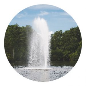
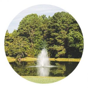
Our fountains are “hybrid” devices that provide much of the attractiveness of high-pressure fountains while still circulating large volumes of water through the air where oxygen is absorbed. Recent design improvements provide many spray patterns with high volumes of water being pushed by energy efficient motors. Like surface aerators, the splashing water sound, surface film reduction and optional deep water intake collars add to their popularity.
surface aerators
These relatively efficient units use an electric motor suspended beneath a plastic float to push high volumes of lake water a short distance into the air where the water can absorb oxygen. Since the water is pushed only a foot or two into the air, the spray is not as attractive as a fountain. However, much greater volumes of water are circulated.
diffused aerators
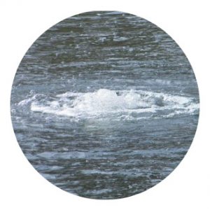
Compressed Air Diffusers: These systems provide up to 3 to 5 times more dissolved oxygen than other methods. A one horsepower motor can circulate 8,000 gallons of water per minute. A properly designed system can eliminate thermal stratification, reduce “muck” accumulation on the bottom, improve water clarity, improve fish production and reduce surface film. Under certain circumstances a one horsepower unit can aerate and de-stratify a 10-acre lake.
repairs & maintenance systems
Our staff has more than 35 years combined experience troubleshooting, repairing and maintaining aeration systems. Several are certified service representatives for major fountain manufacturers capable of providing the following repair services:
- Motor and Pump Change-out
- Float Maintenance and Replacement
- Lighting Maintenance and Replacement
- Electrical Troubleshooting and Repair
- Annual Maintenance Agreements
